One day out at Diane Strugnell’s property near Porirua, Land Management Adviser Jamie Peryer casually compared farm wetlands to a kidney filtering out impurities. Diane suddenly had a lightbulb moment.
Background
Jamie, who works with Greater Wellington Regional Council on its Hill Country Erosion Programme-supported Wellington Regional Erosion Control Initiative (WRECI), was calling at
Diane’s 265-hectare beef farm on the Moonshine Road for a general chat about erosion control.
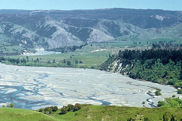
One idea that came up during their brainstorm was fencing off a seven hectare block of Diane’s erosion-prone land, extending the fenceline slightly to include a nearby wetland, enabling it to filter upstream farm water.
“There was no lecture, no judgement. Jamie was just making a point that fencing off wetlands as part of retiring land can actually make stock management easier. I decided to give it a go – and found he was right,” Diane recalls.
“The fact is that my cows don’t like walking through wet areas. And I’ve now got three small wetland areas fenced off, with a few preliminary flaxes and sedges planted out. I named one of the wetlands after Jamie because he was so persuasive about fencing it off!”
Emphasis on positive engagement
Positive engagement of this kind between farmers and councils highlights the value of relationships in land management decision-making. The WRECI is a good example of a
council putting emphasis on partnerships when providing practical information and incentives.
Diane’s farm was one of 286 properties across the Wellington region where WRECI supported farmers in erosion treatment work between 2016 and 2019. Despite challenges with droughts, farm product pricings and tree supplies, the programme currently covers nearly two-thirds of the region’s most erosion prone land.
Jamie says his professional interactions are not always this easy. He takes the long view. “Some farmers pride themselves on being early adopters, willing to try things. Others are more wary of council, and building trust takes time,” he says.
Diane agrees. She recalls being ‘really suspicious’ when she applied in 2014 to be a rural ‘voice’ on Te Awarua o Porirua Whaitua (catchment) Committee. The committee recently
completed the development of recommendations for achieving community water quality objectives in the catchment.
“My committee work totally changed my thinking and understanding about how erosion affects water quality. It also made me more open to a useful suggestion like Jamie’s one of fencing off some of the farm for a wetland as part my wider retirement block.”
How farm plans can help
Farm plans can play an important role in helping landowners look ahead at soil and land use on their properties 20 or even 50 years in the future, adds Jamie.
“We provide them with maps, erosion hotspots and other material to help them visualise things. This gets a conversation going.”
Diane calls her farm plan a ‘work in progress’, a rolling plan developed with Jamie which they can both work on.
“It all sits there in black and white: your vision for your property, the pros and the cons of doing things, costings, along with lots of maps and photos. And you can track changes as you do things. It’s a brilliant tool.”